Friday, December 9, 2011

A Chronology of the Cape Fear

A Chronology of the Cape Fear…


Cape-Fear
Navigation Company.
------
     THE Directors of the Cape Fear Navigation Company, having in discharge of the duties of their appointment, provided Boats, Flats and all necessary fixtures to enable them to carry into effect the provisions of their Charter, and having nearly expended in the purchase of young prime negroes, the balance of the first Instalment on the Stock, are compelled to call on the Stockholders for an additional payment on their respective Shares.  They trust, that with the aid of the present requisition, they will be enabled to make not only a profitable advance, towards the clearing of the North West Branch of Cape Fear, from Fayetteville to Wilmington, but such an one as will insure the patronage and interest of the Public at large.
     The little, that the shortness of the time since they prepared for work, has permitted to be done, justifiey ### ###  to the Stockholders that the result of their exertions will be beneficial.
     They therefore give NOTICE, That an instalment of Ten Dollars on each and every share held in the Cape Fear Navigation Company, will be payable to the Treasurer in Fayetteville, on the first Monday in November next, who will on the receipt thereof issue the necessary Scrip.
     The STOCKHOLDERS will observe that a forfeiture of Shares is provided for by Charter in case of non payment agreeably to Notice.
By Order of the Board of Directors,
J. W. Wright, Treasurer.
Fayetteville, Sept. 28.                                     34  5

------

Stock for Sale.
Cape-Fear Navigation
Stock, offered.
Enquire of the Printer.
October 10, 1816                                        35tf

[The American – Fayetteville, N. C. – Thursday October 17, 1816]

The Ghost of the Steamer Wilmington


The Steamer WILMINGTON (A Prezi Presentation)
On a recent visit to the “North Carolina” Room, of the New Hanover County Library in downtown Wilmington, NC, I found that they were having a “Book Sale.”  I walked over to the cart of books & pamphlets and started to look them over.  I’m sure my eyes lit up when I recognized the face of a small pamphlet which was enclosed in a clear plastic cover.
A Colonial Apparition Booklet 1909The title of the pamphlet was “A Colonial Apparition” with the author being James Sprunt.  I quickly recognized a picture of the Steamer WILMINGTON on the cover.  An attached note said that the booklet was $5. I asked the library representative if she realized that this was an important artifact, “as important as some of those items over in that display case,” I said.  She told me that she was not the usual librarian.  I continued to look through the items for sale, and found a large, old black Bible, KJV, also for $5.  When I started to pay, I only had a $20 bill, and the librarian said she didn’t have change, but I could either “pay by check” or go downstairs to get change.  I wrote out the check.


I wasn’t familiar with the story set out in the pamphlet, but when I got back to my apartment in Fayetteville, I sat on my sofa and started to read.  I immediately became excited by the imagery created by reading the first pages.  I always like developing visual images & vignettes from written words.  I like when something comes to life.  When I can take a description and meld it with my personal experiences and imagine the scene as if I were, or had been, there when, or as it happened.  I understood the first paragraph completely as it described the many winters I had grown up near Swansboro, NC,  “A biting storm of sleet and snow is  seldom seen in Wilmington.  For many years the winter season passed with scarcely frost enough to chill the poor, and then a Christmas season came that will long be remembered for the rigor of its cold..“  It was rare for Christmas or the whole winter season to find snow upon the ground.  If one of my presents was a new football, then I just needed to put on my sweater and coat and head outside to throw the ball around, to myself.  Cold, but not even a dusting of snow on the ground.


The Southport mail boat, Wilmington, made her daily runs without a break,… Captain Harper knew his craft and kept her well in hand.  With steady stare ahead and vice-like grip upon the wheel, he safely steered her up and down, without an accident…
With plank hauled in, the rail secured and hawser neatly coiled, the stately steamer shaped her course.  But ere the double bells were rung, a little rivet broke away from thousands of its kind, and soon caused trouble with the furnace fires.  There was a pause; then a parley through the speaking tube revealed the fact that nothing less than six hours’ work would “mend the kettle” in the engine room…
As the story continued, the passenger’s (Mr. McMillan) historical references addressed to the captain, began to put me to sleep, and these I started to skim, but eventually, we were back upon the deck of the steamer, along side of the Mate, Peter Jorgensen, as he came “face to face” with a hideous haint.  A haint, by the way, is an apparition, and as we mostly call them today, a ghost.  Later, I stood upon the deck of the steamer as all eyes gazed upon the apparition of the kilted Scots.  And when they disappeared, we were almost immediately upon the wreck of a capsized vessel, and clinging to that vessel, two seamen, survivors, but both near the end of their lives. Then quickly came the rescue and arrival of the steamer, at her wharf in Southport, and the brightening sky of Christmas morn.  The tale ended as we followed Captain Harper up to his home and inside, as he kissed his sleeping, “motherless boy.” I closed the pamphlet and put it down on the table, but as I did, I said to myself, but out loud, “Wow.  What a wonderful story!”  *If you would like to read this short story, Google has digitized a book version, which includes photos & drawings of Capt. Harper, the Mate, Peter Jorgensen, the Engineer, Mr. Platt and the Passenger, Mr. McMillan.  **And for more images and info regarding the WILMINGTON.
I made a note to find out when Mrs. Harper had died, for I knew that Capt. Harper had died about a week after the death of his 12 year old daughter, Ella.


NOTE: If you clicked on the link above, “vice-like grip upon the wheel”, and have looked at the image of the hurricane deck and wheelhouse of the Steamer WILMINGTON, you might note the search light on top of the pilothouse.  *I believe that I have read somewhere that this light was originally on the Steamer CITY OF FAYETTEVILLE.  Attention to this advertisement, which includes a drawing of the steamer and a beam of light projecting forward from atop her pilothouse.


Just last night, I once again googled on “City of Fayetteville” and found an index which referenced an article, in the “Marine Engineer” magazine, regarding the steamer.  I then searched to see if this magazine were available online and found it.   Google had digitized the “Marine Engineer” magazine, Vol. 7, which included the June 1902 issue and the article entitled, “Stern Wheel River Steamer.”  The drawings included were of the steamer’s profile, her saloon deck, her engine and a cross-section of the boat.  All “priceless” to a better understanding.

My introduction to the Cape Fear River Steamers came when I first read an account of the Great Fire of Wilmington, North Carolina of the 21st of February, 1886.
The fire started aboard the steamer Bladen which was approaching the end of her 120 mile journey, from Fayetteville to Wilmington.  About 150 yards from her dock, fire was discovered amongst bales of cotton, located near her boiler.  There was a strong, almost gale force wind blowing up from the Southwest, which whipped the flames and spread them quickly from bow to stern, forcing the passengers and crew to flee toward the boat’s stern paddlewheel.


There were eight passengers on board the Bladen that day, Mr. A. J. Harmon  of Bladen County, Mr. Robert Lee of Wilmington, Dodson, a commercial traveler, Mrs. Thomas Hunley and child, Miss Erambert of Richmond, Virginia, and a couple of other gentlemen whose names had not been learned.


Fortunately, several small boats were dispatched from both sides of the river when the alarm went out.  It was stated that for a brief time, before being rescued, Miss Erambert was in great danger, with her clothing being scorched and her hair singed.  All passengers were rescued, however, they lost all their baggage and personal belongings.
Captain R. H. Tomlinson and his mate, Capt. Jeff D. Robeson, were both aboard the Bladen at the time, and Capt. Tomlinson immediately headed the boat for the nearest wharf, that being the dock of the Clyde Steamship Lines.   The fire spread to a nearby lighter which was loaded with firewood and then to the wooden wharf, sheds and buildings along the waterfront.


In addition to the Bladen, another river steamer, the River Queen and a three masted schooner, the Lillie Holmes were burned “to the waterline” and sank where they were tied up.
The Wilmington Morning Star reported that, “Oil, tar, rosin and spirits turpentine in yards adjacent were ready fuel for the devouring flames, and in a very short time the whole river front from Chesnut to Mulberry was ablaze, and the stores and offices on the west side of Water street for the same distance, were enveloped.  The firemen fought manfully and determinedly, but their efforts were futile; nothing could stay the progress of the flames, which leaped and roared like a demon, sending aloft showers of sparks and burning brands, that the high winds carried and hurled on the roofs of buildings squares away from the raging conflagration.”
By the time the fire had been brought under control, the next morning, much of the Wilmington business district had been decimated including the railroad yards and warehouses.  The total estimate of the damage ranged from $500,000 to $1 Million.


I said that the reading of this account was my introduction to the Cape Fear River steamers.  Before reading the article, I wasn’t even aware that steamboats had, or could have run between Fayetteville, NC and Wilmington.  The image I had of a steamboat, at that time, was one like those portrayed in movies which ran on the Mississippi River, large, wide, multi-decked vessels, ornately adorned, capable of carrying hundreds of passengers, large cargoes of cotton, and an assortment of “riverboat” gamblers.  But, what I found were smaller, narrow, light draught vessels capable of navigating the winding Cape Fear, making their way at times, on just a couple of feet of water, sometimes not being able to travel at all because of “low water”, and then having to travel against or with the strong currents of freshets.


The steamboat captains, pilots, boat hands, owners formed an extremely tight-knit group where often, blood or marriage played a large part.  There were many negro pilots which plied the Cape Fear.


The era of the Cape Fear River steamers lasted about 121 years, roughly from about 1818 until 1939, when Capt. Henry H. Hunt tied his boat, the Thelma, up to her wharf at Elizabethtown, NC, where she was left to rot, till this day.  But, during that era, there were many well-known and beloved captains, many boiler explosions, fires, sinkings, drownings, freshets, picnics, excursions, and other incidents which are worth recounting.
And so, I will.

CFRS

Map of the Cape Fear River

Lori on the Cape Fear River  


Map of the Cape Fear River 

Friday, May 21, 2010

Early Cape Fear Exploration to the American Revolution

Early Exploration to the American Revolution
1524-1775
Giovanni da Verrazano, the first known European explorer to arrive in the Cape Fear region, described to King Francis I of France "...the open country rising in height above the sandy shore with many fair fields and plains, full of mighty great woods, some very thick, and some thin, replenished with diverse sorts of trees, as pleasant and delectable to behold, as is possible to imagine." While anchored north of the river’s mouth in 1524, he sent ashore some of his men who encountered friendly natives. "Northern winds" made the mooring unsafe, so they sailed north. 


Spain wished to claim and colonize the area, and the next year sent a ship to explore further. On a map made at this time by Juan Vespucci, a nephew of Amerigo Vespucci, the Cape Fear River is named "R. Jordan." In 1526 Lucas Vasquez de Ayllon sailed from Hispaniola (Dominican Republic) with around six hundred settlers. One of his ships was lost on the shoals at the mouth of the river, and another was built to replace it. After a stay of only a few months the colony moved to Winyaw Bay. King Phillip II of Spain decreed in 1561 that no further attempts were to be made by Spain to colonize "Florida" as the territory was then known.


Queen Elizabeth I opened the way for English colonization by stating the right of the British to conquer and occupy land "not actually possessed on any Christian prince or people." Sir Robert Heath, attorney-general of Charles I, was granted the Cape Fear area, incorporated as the Province of Carolina, in 1629. Heath wanted the land for settlement by French Huguenots, but when Charles forbade the use of the land to any who were not of the Church of England, Heath assigned his grant to George, Lord Berkeley.


Cape Fear, called Cape San Romano by the Spanish, appears on the Mercator-Hondius map of 1606 as "C of faire," and on the John Smith map of 1624 as "C:Feare." The 1651 John Farrer map shows "Cape Feare" with an Indian Fort near the mouth of the river and the word "Secotan" near it.


William Hilton was sent by a group from the Massachusetts Bay Colony to explore the area for a suitable place to settle. He entered the river in 1662 and named it the "Charles River." Town Creek was called Indian River. The Nicholas Shapley map at this time is the first to show the area in detail. The New England group who were impressed by Hilton’s favorable report arrived near the end of 1663, but being dissatisfied with he land departed four months later. The cattle they left behind were kept by the Indians on Smith Island (Bald Head).


The land was renamed Carolina by the Lords Proprietors who had been given the Heath Grant in 1663.


Settlement at Town Creek
William Hilton was again sent to explore the region, this time by men from the British colony of Barbados. He entered the "Cape-Fear" in October 1663 and left in December, evidently just before the New Englanders arrived. John Vassall of Barbados financed and led the first permanent settlers to the Lower Cape Fear, landing in May 1664, and by November had established Charles Town, 20 miles upstream on the west bank of the "Charles River" (Clarendon River on Ogilby’s map in 1672). Vassall had not reached a satisfactory agreement with the Lords Proprietors. Instead they signed an agreement in January 1665 with William Yeamans of Port Royal.

Sir John Yeamans, William’s father, was appointed "governor of our Country of Clarendon neare southerly ..." In October, Sire John stopped at Charles Town on his way to Port Royal and found the colonists in desperate need of supplies. A ship sent to Virginia to relieve this need was wrecked on the return trip. Sir John left in December and never returned. War with the Indians and the indifference of the Lords Proprietors led to the migration of settlers out of the Cape Fear area and by the end of 1667 the site was deserted.


Brunswick Town Further settlement was not attempted for fifty years because of the closing of the Carolina land-office by the Lords Proprietors, the hostility of the Cape Fear Indians and the presence of pirates. In 1715 the estimated number of Cape Fear Indians was 206 people in five towns along the river. Following the defeat of major tribes in North Carolina, the Cape Fear Indians fled south. By 1720 most of the notorious pirates had been captured, including Stede Bonnet who with his ship had been taken in the mouth of the Cape Fear River.


In May 1713, Barren Island (Bald Head) was granted to Landgrave Thomas Smith, and in 1725 Governor George Burrington began to distribute land along the Cape Fear for colonization. Many of the new settlers came from South Carolina because of the lower taxes in North Carolina. Maurice Moore founded Brunswick Town on his grant on the west bank of the river and by June 1726, a map of the town was filed with the Secretary of the Province. The next year a ferry was in operation across the river. A letter of Governor Burrington dated 1773 says he sent out Indian Guides and some of his men to mark a road to the middle of this Province from Virginia to Cape Fear Province River and to discover and view the land lying in those parts until then unknown to the English.


When New Hanover precinct was created by the General Assembly in 1792, the northern coastal boundary was about six miles above the present New River Inlet, and the southern boundary at the disputed South Carolina border. Many people understood the line to be about thirty miles south of the Cape Fear, but the Colonial Records in 1720 designated the border as the "main branch of a large river falling into the ocean at Cape Fear..." In the early 1700's the Cape Fear River below the fork was called the Thoroughfare and the Brunswick River was called the North West Branch of the Cape Fear.


Early Wilmington
A 1735 land grant confirms a previous warrant of 640 acres to John Watson in New Hanover Precinct opposite the Thoroughfare. During 1732 and 1733 lots had been sold on this site for a settlement called New Carthage; streets named were Nansay (Ann), Nunn and Church. The name was changed to New Liverpool in 1733 and the next year to "the New town" or Newton. In 1735 Governor Johnston ordered Court to be held, the Council to meet, and the Land office to be opened in Newton. That same year Roger Haynes was granted land, now Castle Hayne, and two years later Richard Eagles was granted what is now Eagles Island. In 1740 Governor Johnston approved "an Act for Erecting the Village called Newton in New Hanover County into a Town & Township, by the Name of Wilmington..." The town was named in honor of Spencer Compton, Earl of Wilmington, UK.


Area Development from the 1730's to the Revolution
In 1734 Onslow and Bladen Precincts were formed from parts of New Hanover and Carteret Precincts. Later the name precinct was changed to county. Duplin county was separated from New Hanover in 1750, and in 1764 Brunswick County was established from New Hanover and Bladen. St. James Parish which had been created about 1730 was divided in 1741, and the area west of the river became St. Philips Anglican Parish.


Shipping, lumber, naval stores and rice were the main sources of income for the area. In the twenty years after its founding Wilmington was declared an official port of entry, had a shipyard between Church and Castle Streets, a silversmith and a watchmaker, a meeting house and land was deeded for a church.


Because of the war between England and Spain, Spanish ships harassed the area. In 1745 the General Assembly ordered the building of Fort Johnston but it wasn’t completed until twenty years later. In 1748 three Spanish ships entered the river and fired on Brunswick Town. The Spaniards landed and looted the town. The colonists counter-attacked, succeeded in sinking one ship and forced the Spaniards to retreat.


The area developed rapidly during the next twenty years. When the Borough Charter of Wilmington was signed by Governor Dobbs in 1760, with John Sampson the first Mayor, the county population had reached about five thousand. As Wilmington grew Brunswick declined, and the 1761 hurricane which opened New Inlet, seriously damaged Brunswick Town. An attempt was made to build a road between Brunswick and Wilmington across Eagles Island but the foundation of ballast stoned disappeared in the mud as fast as it was put down. In the growing town of Wilmington, the first non-parochial public library in North Carolina was founded, a school was opened, and a church was built. Thomas Godfrey, author of the first drama written by an American and produced upon the professional stage, "The Prince of Parthia," is buried in St. James Church yard.
By 1768 a draw bridge, one of the few in the colonies, had been built at Castle Haynes and new towns had been founded, New Exeter on the North East river and Elizabethtown on the Cape Fear.


When the British Parliament passed the Stamp Act in 1765, the people of the Lower Cape Fear were aroused. Only sixteen days after the Act became effective they forced the Stamp Receiver, Dr. William Houston, to resign. British warships entered the river and seized several ships with unstamped papers. This so angered the people that about a thousand men called "Sons of Liberty" marched into Brunswick Town and obtained the resignation of the Collector of the Port and Comptroller of Customs. The British had spiked the guns at Fort Johnston to prevent their use against the war vessels, and in 1775 the patriots burned the fort. They also sent representatives to the First Continental Congress in Philadelphia. With the avowed Tories and the Scots, who had been forced to pledge allegiance to the British King, Governor Martin assumed he had a sufficient force to subdue the rebellious colonists. The first decisive battle of the Revolution in North Carolina was fought at Moore’s Creek Bridge, near Currie, NC, February 27, 1776, when revolutionary forces defeated the loyalists marching towards Brunswick to join the Governor.


The British landed in Brunswick in the Spring of 1776, looted and burned the town and several plantations, then sailed toward Charleston, leaving warships in the river to harass shipping. In November 1780 Major James Craig and his troops occupied Wilmington. General Charles Cornwallis came to Wilmington in April of the next year, following his victory at Guilford Court House. After eighteen days he marched north, leaving Major Craig and his forces to cope with the North Carolina Militia. Between August and November the Militia was defeated at the Battle of Rockfish near Wallace, NC. Whigs broke the power of the Tories in Bladen County by driving them into the "Tory Hole" at Elizabethtown, and there were skirmishes at the Brick house on Eagles Island, at Long Bridge on the North East River and at Beatty’s Bridge on the Black River. Major Craig left Wilmington in November 1781 following the defeat of Cornwallis in Virginia.


19th Century
The 1790 Census showed 6,800 people in New Hanover County, and new towns were established, South Washington and Smithville, now Watha and Southport. There were toll roads across Eagles Island and Rockfish Creek in Bladen County on "the Great Road from Fayetteville to Wilmington." In 1808 Columbus County was formed from Brunswick and Bladen Counties. During the War of 1812 Brunswick County raised a company of North Carolina Militia, and Fort Caswell, at the mouth of the Cape Fear River, was built in 1816. 
Wilmington was then the largest city in North Carolina, and at the turn of the 19th century was a large port for shipping tar and turpentine.

Innes Academy was opened at Princess and Third Streets on land will by Colonel James Innes before the ‘Revolution’ for a free school. A theatre in the first floor of the building was used by the Thalian Association, an amateur theatre group formed in 1788.


Three newspapers were published in Wilmington by 1804, the Bank of Cape Fear, one of the first two banks in the State, was chartered. That same year the Masonic Order, organized in 1754, erected on Orange Street, St. Johns Lodge, the first building in North Carolina constructed for Masonic purposes.


The need for better transportation brought between 1833 and 1854 three shipyards, three plank roads and three railroads. The Wilmington and Raleigh railroad (renamed the Wilmington and Weldon and then Atlantic Coast Line) was the longest continuous road in the world in 1840 with 161 miles of track. Two side wheel packets, the Governor Dudley and the North Carolina carried the railroad passengers overnight to Charleston, SC. The steamer Step and Fetch-It ferried travelers from Wilmington to the terminal of the Wilmington and Manchester railroad on Eagles Island.
St. Thomas the Apostle Roman Catholic Parish was formed in 1845 and a Christian house of worship was constructed by 1847. St. Paul’s Evangelical Lutheran Church was organized largely by German immigrants in 1858 and a church building was dedicated on August 22, 1869. In the years before the Civil War, six new Academies were incorporated, the Carolina Yacht club was organized and Oakdale Cemetery established. Thalian Hall, a neo-classic theatre built on the site of the old Innes Academy, opened in 1858.


The Lower Cape Fear area took an active part in the Civil War. After 1866 shipping was hampered by the shoaling of the river due to silt and the enlarging of New Inlet. Twelve appropriations were made by the United States Congress from 1870 through 1882 for river improvement. With the Army Engineers in charge, work was begun in 1871 to close New Inlet by creating stone breakwaters along the east side of the river channel.


In the following decade a new railroad was completed, the Cape Fear Club organized and the College of Physicians established on the west side of Third Street between Princess and Chestnut. The Jewish Congregation, organized in 1867, began construction on the Temple of Israel, the first house of Jewish worship in North Carolina.
The 1870 New Hanover County Federal Census recorded 28,000 people, of whom 13,500 lived in Wilmington.
Pender County was formed in 1875 from New Hanover, leaving New Hanover, one of the three original precincts, next to the smallest county in the state.


This period saw the beginning of the industries such as the fertilizer industry, truck farming and commercial fishing which continued to be a basis of Wilmington’s economy for several years. The production of rice had declined, but with the development of the creosote process, lumber became an important industry. By 1896 Wilmington ranked as a major port for exportation of naval stores and cotton continuing into the 20th Century. When the eastern Carolina railroads were consolidated, Wilmington became a major rail center.
Compiled from an original script by Leora Hiatt McEachern and Isabel Williams
for the Greater Wilmington Chamber of Commerce circa 1976.  Additions by staff of New Hanover Public Library Special Collections


Bibliography

  • Boyd, William K. History of North Carolina, Vol. II, Chicago, 1919
  • Brown, C. K. A State Movement in Railroad Development, chapel hill, 1928
  • Colonial Records of North Carolina, edited by William L. Saunders, Raleigh, 1886 - 1890
  • Evans, W. McKee Ballots and Fence Rails, Chapel Hill, 1966
  • Fisher, R. H. Biographical Sketches of Wilmington Citizens, Wilmington, 1924
  • Lee, Lawrence The Lower Cape Fear in Colonial Days, Chapel Hill, 1965
  • Milling, C. J. Red Carolinians, Chapel Hill, 1940
  • North Carolina Business Directories, 1866 - 1877
  • North Carolina State Board of Agriculture, North Carolina and its Resources, Raleigh, 1896
  • North Carolina State Department of Archives and History Publications:
  • Cumming, W. P. N. C. in Maps, 1966
  • Corbett, D. L. Formation of N. C. Counties, 1663 - 1943, 1950
  • Historical Highway Marker Guide, 1864
  • Rankin, Hugh F. The Pirates of Colonial N. C., 1960
  • Historical Review, Autumn 1964, Wright, J. Leitch, Jr. Spanish Reaction to Carolina
  • Historical Review, Winter 1964, Powell, William S. Carolina on the 17th Century and Annotated Bibliography of Contemporary Publications.
  • North Carolina Department of Conservation and Development, American Guide Series, N. C., Chapel Hill, 1939
  • Prince, Richard E. Atlantic Coast Line Railroad, 1966
  • Sprunt, James Chronicles of the Cape Fear River, Raleigh, 1914
  • Waddell, Alfred M. History of New Hanover County & Lower Cape Fear, Wilmington, 1909
  • Wheeler, John H. Historical Sketches of North Carolina, 1851
  • Williams & McEachern Records Lower Cape Fear 1861 - 1865
  • Wilmington City Directories & Newspapers

The Haunted Courthouse

The Haunted Courthouse
On the stairs of the old Courthouse

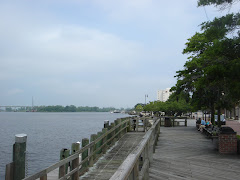
Cape Fear River

Cape Fear River
Looking west toward the Hilton

Ship coming into Port of Wilmington

Ship coming into Port of Wilmington

Ship News

Ship News